
Identity
PNK for passengers, WIOO for aviation
The Directorate General of Civil Aviation lists Supadio as an international-use airport managed by PT Angkasa Pura Indonesia and located in Limbung, Sungai Raya, Kubu Raya Regency.
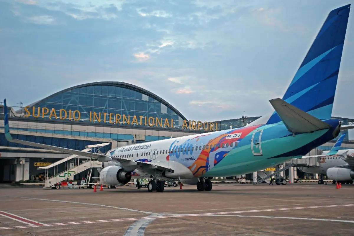
The air gateway to Pontianak
An independent visitor guide to the airport, ground access, facilities, history, and regional context, without commercial promotion.
Location
Limbung · Sungai Raya
Operating hours
06.00–20.00 WIB*
Airport code
PNK / WIOO
Google Maps rating
4.4/5 · about 8,000 reviews*
*Operating hours and ratings may change. Confirm operational information through official channels and your airline.
Know Supadio
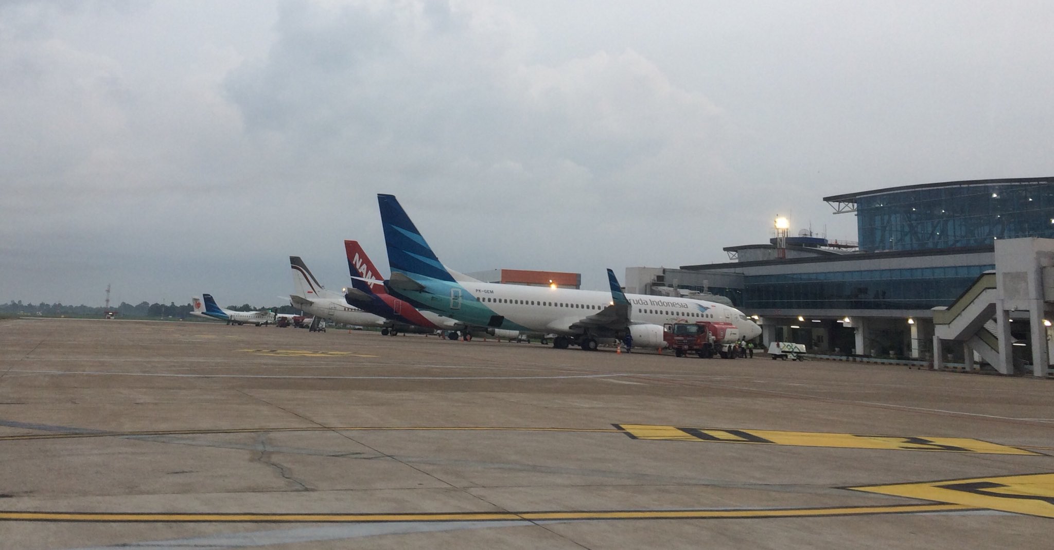
Supadio Airport stands in Kubu Raya Regency and serves as a major air node for Pontianak as well as travel across West Kalimantan.
Identity
The Directorate General of Civil Aviation lists Supadio as an international-use airport managed by PT Angkasa Pura Indonesia and located in Limbung, Sungai Raya, Kubu Raya Regency.
Historical trace
Historically the airport was known as Bandar Udara Sungai Durian before taking the name Supadio. The new terminal was inaugurated on 28 December 2017. State Secretariat records also note the use of Dayak ornamentation on the terminal facade, placing West Kalimantan identity at the point of arrival.
Passenger experience
ACI Asia-Pacific & Middle East lists Supadio as a winner in the Best Airport category for 2-5 million passengers in Asia-Pacific in the 2024 ASQ Awards. The award relates to passenger experience and does not change the independent nature of this guide.
Archives, local narratives, and airport studies
This area is more than a civil terminal. The Indonesian Air Force history of Supadio Air Base traces the earlier Sungai Durian airfield, while regulator data explains its role in the modern aviation network.
Early period
The Indonesian Air Force historical profile notes that the Dutch colonial government once planned an airfield at Sungai Durian. Construction later continued under Japanese occupation, and the site developed into a strategic aviation node.
Indonesian period
Reconstruction efforts are recorded as beginning in the early 1950s. In the Air Force chronology, Pangkalan Udara Sungai Durian became Pangkalan TNI AU Supadio in 1969.
Modern terminal
The new terminal opened on 28 December 2017. State Secretariat records mention Dayak ornamentation as part of its architectural character.
Local oral record
The Indonesian Air Force history records an oral tradition that settlers along the river planted durian trees until the village became known as Sungai Durian. We present it here as documented oral tradition, not as a standalone archaeological finding.
Runway
2,600 × 45 m
Verified dimensions listed by the civil aviation regulator.
Classification
4C
Airport classification code shown in the regulator profile.
Reference aircraft
Boeing 737-800
Listed by the regulator as the reference aircraft.
Use status
International
Use status shown in the Directorate General of Civil Aviation profile.
Before you leave
01
Use your airline app or official airline channels. Do not rely on static schedules from a guide site.
02
Add buffer time for Pontianak-Sungai Raya traffic, parking, and queues.
03
Make sure identification, tickets, and any supporting documents match your route and airline requirements.
04
Follow official signs for taxis, app-based vehicles, private cars, and designated pick-up areas.
Detailed transport
Because Supadio itself is the airport, this section covers both flying into PNK and reaching the terminal by road from Pontianak and nearby areas.
Use the IATA code PNK when searching for flights. Once you land, you are already at the site covered by this guide; continue to arrivals, collect baggage, and choose ground transport from the official zones.
The general approach follows Jalan Ahmad Yani toward Jalan Arteri Supadio. Travel time is often measured in tens of minutes, but congestion, rain, and peak hours can change it.
A direct option from the city or the terminal. Use official zones, confirm the fare or fare method before departure, and avoid unclear offers.
Availability depends on time and pick-up rules. Follow app instructions and airport pick-up zone signage.
Service can change by operator and period. Confirm route, timing, boarding point, and payment on the day of travel; this site intentionally avoids publishing unverified fixed schedules.
Enter through the airport arterial corridor. Distinguish drop-off lanes from parking areas and allow time to enter and leave the terminal complex.
Intercity travel usually requires a separate road connection to the Sungai Raya corridor. Plan transfers and time buffers independently.
Facilities & practical needs
Look for toilet symbols in the public terminal area. For accessibility needs or specific assistance, ask airport staff.
Prayer spaces are generally available within the terminal area; follow signage because access locations may change.
Power outlets may be available in waiting areas. Bring your own adapter or cable and do not leave devices unattended.
ATM or payment facilities may vary by terminal area. Carry more than one payment method for travel needs.
Food services are available in the terminal and along the route toward the city. This guide does not endorse particular outlets or brands.
Look for convenience-store type services in the terminal or along the airport road corridor and check opening hours at the time of arrival.
Follow display screens and signs for baggage claim and check-in counters. Baggage issues should be handled directly through the airline or relevant airport staff.
If you need a rental vehicle, use licensed services, understand the rental terms and insurance cover, and confirm the handover point without relying on brand promotion.
Passengers who need wheelchairs or other assistance are advised to arrange support with the airline before departure.
Transit accommodation options are available along the airport corridor and in central Pontianak. Choose by transfer needs, city access, and budget rather than by brand ranking.
Fuel stations are available on the main road corridor. Electric vehicle charging availability may change; check operator maps before relying on it.
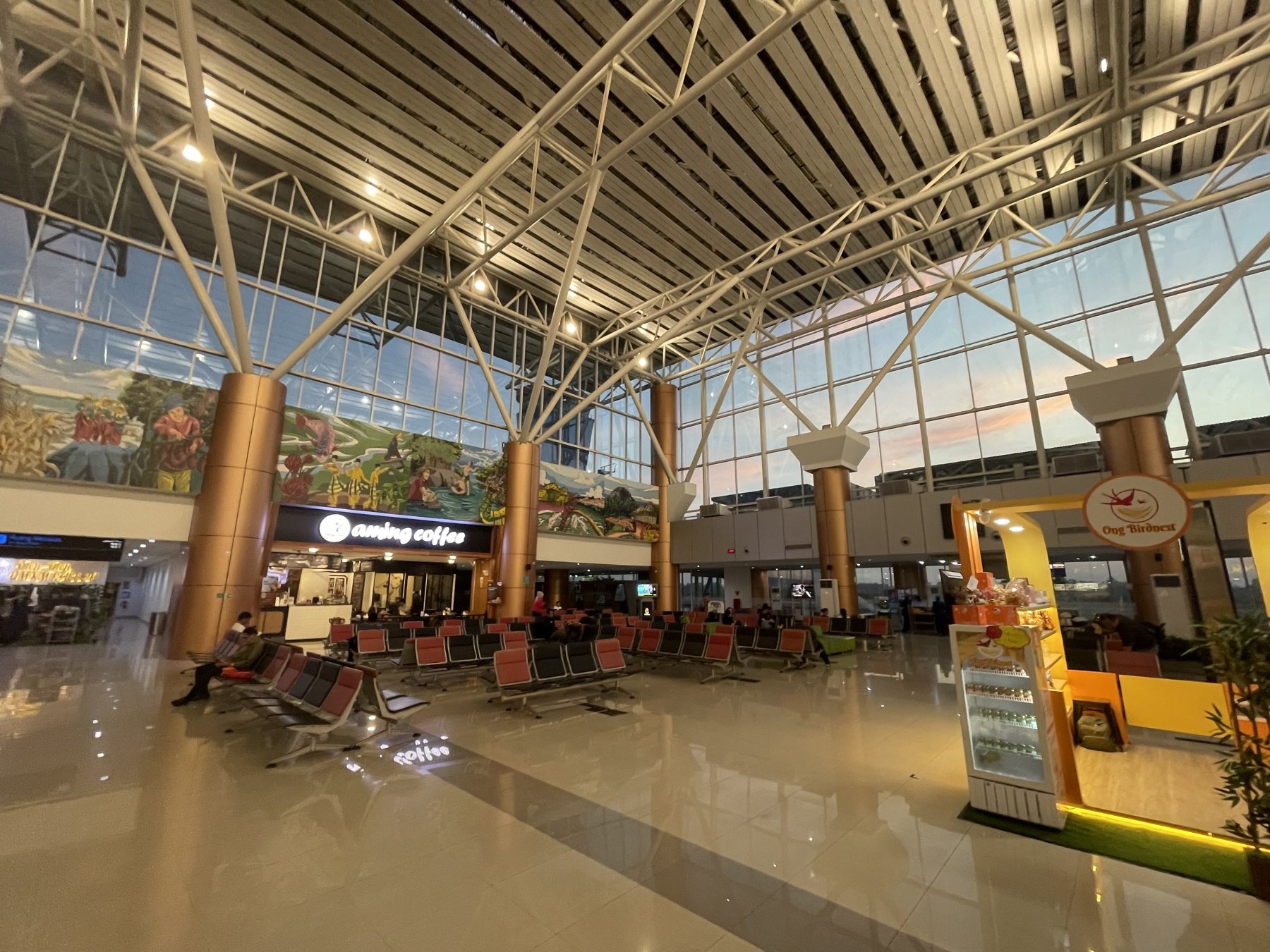
Terminal interior. Photo: SunDawn, CC BY-SA 4.0, via Wikimedia Commons.
Passenger flow
Detailed layouts may change, but understanding the order of airport functions helps visitors read the space without depending on a floor plan that quickly becomes dated.
Departure
Arrival
Health, assistance & accessibility
The Directorate General of Civil Aviation profile lists medical facilities and an Airport Health Office at the airport. For wheelchairs, accompaniment, medical conditions, or other specific needs, it is best to coordinate with the airline early and ask terminal staff for help. In urgent situations, prioritise on-site staff and local emergency services.
Tickets / costs
The public terminal area is not a ticketed tourist attraction. Flight tickets, parking, ground transport, premium waiting areas, excess baggage, and optional services all carry their own charges. For values that change, use the official rate at the point of transaction.
Parking
Parking is available within the airport complex. Distinguish between drop-off, pick-up, car parking, and motorcycle parking zones. Rates and rules may be updated; official signs at the entrance are the main reference.
Time & duration
For air travel, follow the airline check-in deadline and add buffer time for the road journey. If you are only dropping off, picking up, or orienting yourself in the public area, around 45-90 minutes is usually sufficient. Morning road travel may feel easier, but tropical weather can change quickly.
Around the airport
The options below are categories of service or public cultural places. We do not rank restaurants, hotels, shops, or transport providers.
Along Arteri Supadio and the Ahmad Yani direction you will find local eateries, food stalls, coffee shops, bakeries, convenience stores, and family dining venues. Choose based on hygiene, clear pricing, dietary needs, and opening hours.
For travel needs, look for supermarket or minimarket categories, hotels or transit lodging, pharmacies, fuel stations, workshops, and, where available, EV charging points. Verify actual availability before departure.
Public place
A public landmark introducing Pontianak as a city on the equatorial line.
Allow 30-60+ minutes to reach the city area, depending on traffic.
Public place
A space for regional history, culture, and collections from West Kalimantan.
Allow 30-60+ minutes to reach the city area, depending on traffic.
Public place
A cultural building representing the Dayak longhouse tradition.
Allow 30-60+ minutes to reach the city area, depending on traffic.
Public place
A public riverfront space on the Kapuas in central Pontianak.
Allow 30-60+ minutes to reach the city area, depending on traffic.
Location map
Limbung, Sungai Raya District, Kubu Raya Regency, West Kalimantan. The embedded Google Map below uses Indonesian regional settings.
Guide coordinates: -0.1476038, 109.4027084
Questions & answers
Official airport channels list operating hours as 06:00-20:00 WIB. Flight operations may change, so check airline schedules and official channels before travelling.
There is no sightseeing ticket for the public area. Restricted zones follow security checks and aviation rules; services such as parking or transport are charged separately.
Taxi, app-based vehicles, private cars, or any available shuttle or bus service. For public transport, confirm the current schedule on the day of travel.
Basic passenger amenities are available in the terminal environment, but exact points and hours may change. Follow signage and ask staff if you need a specific facility.
Yes. Parking areas are available within the airport complex. Use official zones and check the latest on-site tariff signs.
Follow your airline check-in deadline and add time for the road journey, parking, security screening, and possible queues.
No. Supadio Guide is a nonprofit information project and does not sell tickets, accept bookings, or build commercial rankings.
Always prioritise operational information from the airport, airline, staff, and regulator. Fast-changing information on this site is intended as an initial guide only.
The IATA code is PNK (PNK) and the ICAO code is WIOO (WIOO). Use PNK when searching for or booking flights.
Sources & methodology
Airport identity, location, operator, operating status, and technical data are prioritised from the regulator. Historical sections rely on government archives. Awards use ACI. Google Maps ratings are treated as a snapshot at the time of checking, not as a fixed fact.


